|
|
|
|
|
|
|
|
|
Research Notes 2014
| December 2014 - Green Combe View Car Park |
|
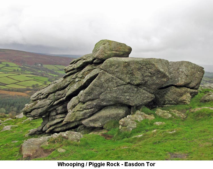
1) Liapa (Leeper/Leapra) Cross (SX7022/8332) This cross was first noticed by William Crossing and mentioned in his 'The Ancient Stone Crosses of Dartmoor' and in his 'Guide' In the early years of the 20th Century, the cross was found built into the garden wall at Moor Gate Farm. At the time, the farm was known as Leeper Farm, hence the name given to the cross. The cross was then moved to the Manor House at North Bovey, by the Lord of the Manor, Viscount Hambledon. It was returned to its current position when the manor changed hands in 1937. (Source: Crossing & Dartmoor Crosses Website). 2) Whooping / Piggie Rock (SX729/822)
3) Figgie Daniel Tor (SX7348/8229) Figgie Daniel Tor is a large rock pile about 500 yards to the east of the summit of Easdon Tor and close to a large cairn. No-one seems to know how it got it's name but, viewed from a certain angle, the top does vaguely resemble a human face and it was probably named after a local character. The south east face of the tor presents a sheer surface of about 25 feet in height and is a popular site for training rock climbers. (Source: Hemery, & Legendary Dartmoor Website). 4) Fishes Stones (SX7245/8084 & SX7166/8101)
|
| November 2014 - Rowtor Car Park |
|
1) Irishman’s Wall (SX606/921 to SX620/918 plus others, as below) From Cullever Steps a distinct line will be noted rising up the western slope of Belstone Tor. This was part of an abortive act of piracy in the early 1800’s by an Irishman, named Crawford it is believed, to enclose an extensive part of the commons. The wall continues on the eastern side of the tor where it drops to meet the Taw’s left bank. Up in Steeperton George will be found a continuing section which joined a reave below Knack Mine running westward over the ridge and thence alongside Sammy Arnold’s Lane to a point on Middle Hill. Further remains will be noted on the left bank of the Black-a-ven Brook below New Bridge (the original of which was constructed at the same time as the wall) to Stone (Hartor) Ford east of Row Tor. It is also thought that part of the Hart Tor enclosures belong to this venture. The story goes that on hearing of this plan the men of Belstone and Okehampton, realising the immense tract of commons that would be cut off from the forest, said nothing, but permitted the work to proceed with no intention of allowing its completion. When a fitting opportunity occurred they met in force and made such breaches in the wall as to render it useless. (Refs: Hemery and Crossing). 2) Henry's Ford (SX6064/9100) The ford that we were unable to cross on today's walk, due to the high water level, is Henry's Ford which is located on the East Okement River within Rithy Pits in Skit Bottom. According to Eric Hemery it is a ‘contemporary instance of a personal name being attached to a local feature’, which in this case relates to Mr Henry Cooper who, when Hemery was compiling his ‘High Dartmoor’, was the current occupant of East Okement Farm (aka Hartor Farm). It is not known who christened the ford thus and it can only be surmised other local commoners had cause to do so. (Source: Eric Hemery's High Dartmoor, pages 871 & 873 & Crossing). 3) Sammy Arnold’s Lane (SX5885/8880 to SX 6080/8893) Although mentioned on several occasions by Hemery, nowhere is the route of this lane clearly delineated. An ancient track ran beside the Moor Brook’s left bank and thence under the eastern side of West Mil Tor in a southerly direction from Moorgate to Dinger Plain. It was used extensively for the conveyance of peat from old turf ties found on the left bank near Brim Brook Head. With the arrival of the military it was adopted as one of their access routes for artillery practice with others being constructed over the coming years. Connecting this initial route to two others in the east is the lane referred to as Sammy Arnold’s, over which it is said the named moorman brought countless packhorse loads of peat from Dinger Plain to Knack Mine. On our walk we passed its eastern end and crossed its middle. The visible track runs from SX5885/8880 to SX6080/8893 fording Black-a-ven Brook and East Okement, but what is not clear is whether the reave running further east from the latter co-ordinates was followed or a southerly diversion taken along the military track before turning north-east to drop into the valley of the Taw. (Refs: Hemery & Crossing). 4) Observation Post - OP15 (SX6025/8776)
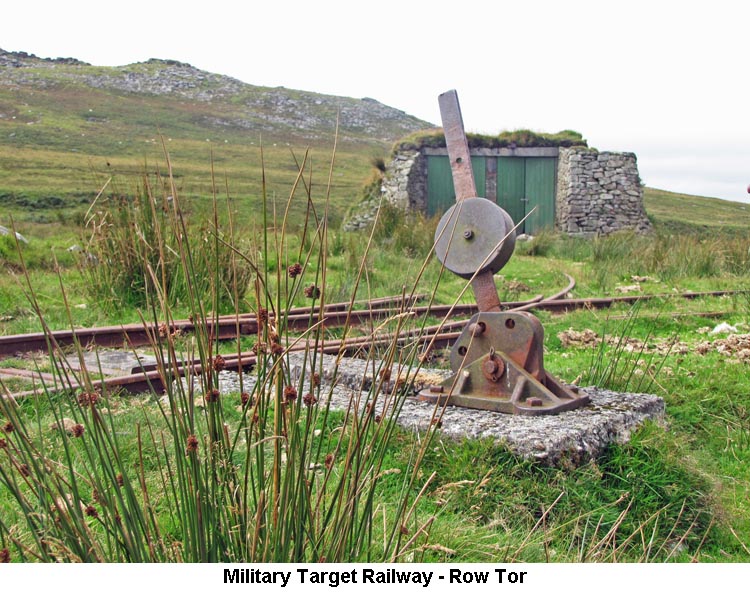
5) East Mil Tor - Military Target Range Railway (SX6029/8983 to SX6039/9083) Hemery writes in High Dartmoor about wooden figures of soldiers being carried on a small trolley hauled by rope windlass to provide moving targets for practising riflemen. An Internet source suggests it being a bit more involved and linked to artillery practise. Okehampton Camp was built between 1892 and 1894. It accommodated, at any one time, two brigades; each consisting of approximately 170 men and 90 horses, with 4 batteries of 6 guns, that usually trained at the camp for a fortnight. An additional 10,000 acres of High Moorland were subsequently leased from the Duchy of Cornwall and used from May to September each year. The batteries were presented with an imaginative firing programme using an elaborate system of static and moving targets representing almost anything that might appear on the battlefield. Life was given to this complex system by ropes and pulleys, activated by teams of horses from a permanent staff gun battery. The longest moving target system, down the eastern slopes of East Mil Tor from OP6 into Skit Bottom, was constructed before the eastern ‘ring road’. It is thought that guns were positioned at East Okement Farm or along Oke Tor Ridge. Targets were positioned on perhaps ten trolleys that had been pulled to the top of a gradient and then released to represent a cavalry attack. There is no indication of an engine for returning trolleys to their starting point so it is thought ponies were employed. The 18 inch gauge rails were lifted in 1982 but unserviceable for further use. Initially, communication with the target operators would have been by flag. Later, an extensive telephone system was laid. The range control telephone exchange for the target array was on Winter Tor. It is said that the men who dug in the lead covered telephone lines were paid by the yard and weren’t allowed to deviate from a straight route - even if they had to dig through a granite boulder. The visible remains of the target railway run from south facing bunker OP6 (SX6029/8983), on East Mil Tor’s eastern slopes, for approximately 1070 metres in a northerly direction; crossing the ‘ring road’ and ending on a turf covered causeway at approximately SX 6039/9083. Some decaying wooden sleepers will be noted in the section south of the ‘ring road’ whilst at the point it crosses the road two pieces of rusting rail still remain. At various locations along the eastern side wall of this cutting like section holes, lined with hewn granite blocks, can be seen; whether these were for drainage or part of the ‘pulley’ system is unknown. Some further sleepers and rusting rails will be found at the ‘causeway’ end. (Refs: Hemery, an authorless Internet paper and Bob W.).
|
| October 2014 - New Waste |
|
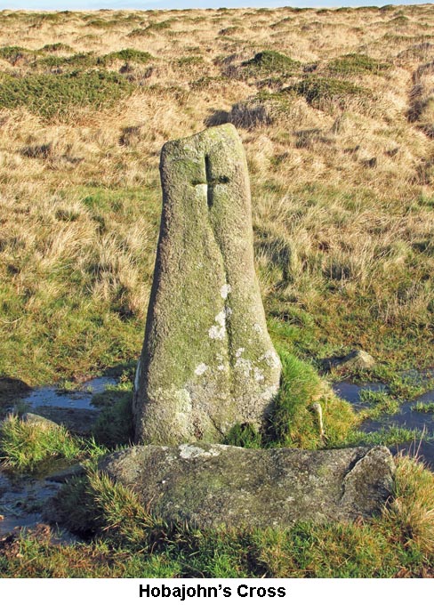
1) Butterdon Stone Row Recorded on a map (possibly circa 1478) and second only in length to the Erme long row, it commences at a barrow with retaining circle near the summit of Butterdon Hill and extends for about 1¼ miles towards Piles Hill terminating at a now leaning menhir known as the Longstone. As the row crosses a depression above the head of the Butter Brook some shooting butts, constructed in 1861, will be noted. Hobajon’s Cross (a standing stone bearing an incised cross and 1791 yards from the Butterdon end) marked what was considered the terminus of the row until a map from 1799-1800 by Modbury solicitor John Andrews depicted its former forgotten extension 890ft further on. For reasons unexplained this section had been removed in 1803. Certain stones in the row have marks indicating they were cut by the tare and feather method and added when the row was accepted as a boundary between Harford and Ugborough (Langford Lester Moors) by disputing parties in the same year that the northern members disappeared. (Source: Butler, Crossing, Hemery, Starkey & Worth).
The boulder now standing at this spot was never a cross in the accepted sense, but it does have an incised cross on its west face. However, it is thought that an actual cross stood on this spot and that it was removed in 1557 by Sir William Petre and re-erected on Three Barrows as one of the four crosses that marked the boundary of his Manor of South Brent. (See Three Barrows Cross below). The original cross has been replaced by a natural boulder, with an incised cross, which falls on the line of the Ugborough/Harford Boundary Stones. (Source: www.dartmoor-crosses.org.uk). 3) The Redlake Tramway In the first decade of the twentieth century the newly formed China Clay Corporation of Ivybridge declared an interest in mineral rights around Redlake and obtained a 31 year lease from the Duchy of Cornwall. Richard Hansforth Worth was appointed as engineer and after much local opposition the venture commenced in 1910. A 3 ft gauge tramway was laid for the purpose of conveying workers, coal for steam pumping engines, iron and general supplies to the site at Redlake (1460 ft asl). It ran from a location above Bittaford (740 ft asl) following the contours of the hills for a distance just short of 8¼ miles, its highest point being at Brown Heath (1490 ft asl). Locomotives and carriages were stabled in sheds above Bittaford and a little further westward a rail link to two transfer sidings at Cantrell Works, next to the GWR mainline, was connected via a cable controlled incline. Officially opened in September 1911 it took until the end of 1913 for all work to be completed and production at the pit to commence. Clay was moved for final processing at Cantrell, suspended in water through two 9 inch diameter stoneware pipes running from mica beds near Crossways - a distance of some 8 miles. Returning from the clay pit wagons would carry the coarse sand removed in the extraction process that would be sold on as fertilizer or for building purposes. Near Spurrell’s Cross a passing rail loop was installed and at Three Barrows a siding provided where a stone crusher was located for generating ballast; the remains of its concrete base and tie-down bolts are still visible. The First World War and its after effects led to the eventual collapse of the Corporation in 1919. A new body, the Ivybridge China Clay Co Ltd, reopened the works in 1922 along with new facilities at Leftlake. Here a new siding was laid and just south of the bridge, on the Erme side, will be found the remains of a winding house where an engine was installed to work the pit incline. The sand and mica drags lying to the east of the track were connected to the existing pipeline though the yield per ton was lower than Redlake’s. The clays from both sites were sent down on alternate days to prevent cross contamination as Leftlake’s material was of a lower standard to that from Redlake. Output increased up to 1928 but after a few years all suitable clay deposits had been extracted being inferior compared to other local works. The depression was looming ever closer and by 1932 the enterprise folded; one year later the whole system had been completely dismantled and disposed of. On the northwest parapet of Leftlake’s bridge a strip of mortar has been smoothed off and on it inscribed - BRIDGE (X) 31.7.63. – the significance of this has not been established. (Source: Harris, Hemery & Wade). 4) Le Rowe Rew (Ancient Reave) This is a prehistoric reave (causeway-like in places) and by medieval times was treated as the boundary between the Commons of Ugborough and South Brent. Aligned with the central cairn on Three Barrows it spans both sides of the hill (north to south) measuring in total just short of a mile in length. The northern end terminates at a stone set in a tiny cairn. (Source: Butler, Crossing & Hemery). 5) Three Barrows (SX653/626) a) Cross Head: In 1557 four crosses were erected on the southern moor to mark the boundary of the Manor of Brent. This manor was previously part of the Buckfast Abbey Estate but after the dissolution of the Monasteries in 1539, the Manor was owned first by Sir Thomas Denys and then by Sir William Petre and it was the latter who had the crosses erected. Two of the crosses, Huntingdon Cross (SX6645/6617) and Petre's Cross on Western Whittabarrow(SX6535/6549), are still in position on the moor. However, the cross erected at Buckland Ford, on the River Avon, has not been seen for at least a hundred years. The mutilated head of the fourth cross was probably the original Hobajohn's Cross and is reputed to be lying amongst the mass of stones comprising the cairns on the summit of Three Barrows. The head was found by the Rev Spence Bate when excavating one of the Barrows in 1872, but in a mutilated condition. The damage could have been inflicted by high-spirited young soldiers who were camped on Harford Moor and involved in constructing the aforementioned practice-firing range. Over the years the damaged cross has vanished and reappeared only to disappear again. It was last observed in 1957 and possibly in 1973. Please see an update to these notes written after our further visit to the site in September 2016. (Source: Harry Starkey's Dartmoor Crosses, pages 21-22, Butler, Crossing, Hemery, Starkey & Worth). b) Aircrash Site (SX6536/6266): Just to the east of the central cairn at Three Barrows, we came across a small amount of wreckage from an RAF Vickers Wellington B Mk.X LN775. On March 1st 1944, whilst on a transfer flight from Hurn in Dorset to Mediterranean Air Command at Rabat Sale, Morocco, the aircraft drifted 25 miles off its briefed route. Then, whilst flying along westerly track in low cloud, it struck the hillside and caught fire killing all four crew: P/O F J Cook (pilot), F/Sgt W M Jack (navigator), Sgts A G Beeston and J J Yeates (both WO/AG). The aircraft remains were located three days after the incident. A visible scar is just east of the central cairn (Dartmoor’s largest) in which there is some melted aluminium and heat discharged 0.303in cartridge cases. (Source: Legendary Dartmoor & Wotherspoon et al).
|
| September 2014 - Venford Reservoir |
|
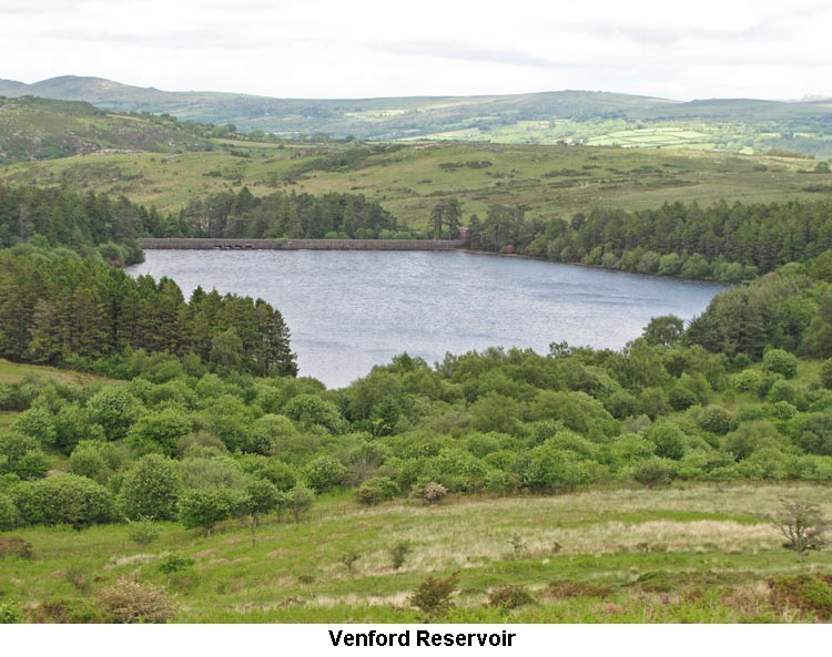
1) Venford Reservoir (SX686/711)
A single arch bridge that carried the old road lies under water just north-west of the middle of the reservoir. From internet research a PUDC boundary stone at SX 68412 71227 (near the ‘western’ car park) has a faint surveying benchmark on its reverse face. There is at least one other PUDC boundary stone with a benchmark inscribed on its front face, but its location was not given. The kerbed ‘roadway’ on the right bank of the Venford Brook below the dam encloses the Paignton service pipe. 2) Hangman’s Pit/Hollow (SX6725/7150) Hangman's Pit is the site where it is said a suicide was committed in about the first quarter of the 19th Century. A moorman from Round Hill, near Two Bridges, whilst returning from Brent Fair, where he had exchanged his horse for another (most probably due to over-conviviality) discovered with his returning sobriety that he had received the worst of the bargain. It was supposed that fear of his wife’s reaction to his disastrous transaction lead him to hang himself from a tree with the horse’s halter. 3) Horse Ford (SX6637/7112) This is a location on the O Brook (Wo Brook) where the Buckfast to Buckland track crosses. In William Crossing’s day it was paved with flat stones and a stone on the east side was cut with a large letter ‘H’ to denote the parish boundary of Holne, the brook being in the forest. Eric Hemery states that the ford was destroyed by a flood in 1965 to be replaced by waterslides, cascades and rowan trees. It is near here that the feeds of two leats start whilst another was conveyed across the O Brook by aqueduct. A new parish boundary stone was erected at the ford (SX66376/71126) in 1995 to replace the one washed away in the flood. It is inscribed 'H' and 'AB' on one side and '1995' on the other, and is placed in honour of Arthur Brown - former foreman of the Manor Jury in 1949 and reeve from 1962 until his death in 1993. (Source: web blog Johnie’s Meanderings.). From the feeder on the right bank of the O Brook near the ford can be seen what looks like a cave on the north-west side. According to Jeremy Butler this is an adit. 4) Hooten Wheals (SX6560/7088)
5) Leats on Holne Moor (Various Grid Refs.) The numerous leats and reaves as represented in this area on OS maps become confusing and difficult to trace and identify. Of interest on the walk were four leats: Hamlyn’s (Holne Moor) and Holne Town Gutter [both running], and Wheal Emma and Cumston Farm [both dry]. Outwards, and after crossing Venford Brook, Hamlyn’s Leat was followed with Wheal Emma above. On leaving Combestone Tor the Cumston Farm Leat was followed with Hamlyn’s below and Wheal Emma above. Homewards the Holne Town Gutter was encountered and then the Wheal Emma Leat followed. a) Hamlyn’s (Holne Moor) Leat pre-dates the Wheal Emma leat and is linked to the Buckfastleigh woollen trade of the early 19th Century when it was constructed to provide a reliable source of mill water. It commences just below Horse Ford and follows the contours around to a point near the road above and north-west of Venford Reservoir where it is currently taken by siphon under the Venford Brook to re-emerge on Rickett’s Hill south of Bench Tor. From here if flows across the moor and into Great Combe to join Holy Brook. Its original path around the southern edge of the reservoir is now dry. b) Cumston Farm Leat took its supply from the O Brook above the Hamlyn’s Leat take-off but below the Wheal Emma aqueduct and might pre-date the aforementioned leat. Hemery has postulated that it might also have fed a waterwheel at Wheal Cumston Tin Mine. c) Wheal Emma Leat was cut in 1859 to feed a copper mine near Buckfastleigh. It began its lengthy 9¼ miles course near Stream Hill Ford on the Swincombe, winding its way above Hexworthy and Saddle Bridge to cross the O Brook by aqueduct above Horse Ford. Following the contours it passed below Combestone Tor to go around and above the then non-existent Venford Reservoir to continue around Holne Lee, reaching the proximity of Scae Wood before falling into the River Mardle above Chalk Ford. d) Holne Town Gutter takes its supply from the stream that runs out of Ringleshuttes Gert. It feeds farms above the Dart between Bench Tor and Holne as well as reaching Holne in its own right before descending into the Holy Brook at Langaford. 6) Sandy Way This is a path running from Holne and Scoriton through Michelcombe and thence via the high ground of Holne Moor to Aune Head, passing near the Luckombe Stone to finally reach the lower end of Fox Tor Mire and Whiteworks. The area beneath Fox Tor is called Sand Parks on the extreme edge of which is Childe’s Tomb; it is possible that the name is derived from this locality. It's route on the OS 1:25,000 series map of 2008 is poorly shown and near Aune Head (SX652696 – SX663696) is indicated more as a water course.
|
| August 2014 - Merrivale |
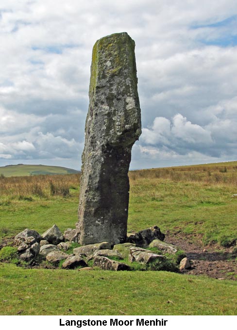
1) Over Tor & Mrs Bray's Wash-Hand Basin (SX5578/7526) Although not named on the Ordnance Survey maps, the Tor we encountered just after entering the moor at the start of the walk, and below Little Mis Tor, is called Over Tor. On top of the main stack is a substantial Rock Basin which goes under the name of 'Mrs Bray's Wash-Hand Basin'. It seems it was given this name by the Reverend Edward Atkins Bray after his wife, Anna Eliza Bray, had washed her hands in the water of the rock basin during one of their sorties onto the moor. (Source: Eric Hemery's High Dartmoor, page 1045). 2) River Walkham / Blacka Brook Water Course (SX572/780) Way back in time, the upper reaches of the River Walkham was, in fact, the Blacka Brook which flowed in a southerly direction, passing close to Princetown and joining the West Dart River near Prince Hall. At that time, the head of the Walkham was somewhere between the foot of Greena Ball and that of Cocks Hill. Gradual erosion took place and the head of the Walkham edged forward in an easterly direction, eventually breaching the bank of the Blacka Brook at the grid reference shown above. This effectively meant that the Walkham had diverted the waters of the Blacka Brook into it's own course and the easterly bend in the Blacka Brook gradually silted up. The head of the Blacka Brook is now about half a mile to the south east of the breach, near the top of Black Dunghill. (Source: Eric Hemery's High Dartmoor, page 1045). 3) Langstone Moor Menhir (SX5502/7874), Stone Row (SX5505/7874) & Stone Circle (SX5563/7820)
The stone row, which runs northward from the Menhir, was discovered by the Reverend Sabine Baring-Gould in 1893. Although the stones are very low to the ground, the row runs for about 110 yards and terminates at a ruined cairn. It is thought that the stones about 70 yards to the west of the stone row was another cairn and stone row, which has been since been converted into a Reeve, but this cannot be proved. The stones of the Stone Circle are also of epidiorite, but these have suffered more than the Menhir from being used as wartime target practice, resulting in several being broken off above ground. The Stone Circle, which is about 60 feet in diameter, is known to moormen as the 'Ring-of-Stones'. (Source: Eric Hemery's High Dartmoor, pages 953/954 & Thurlow's Dartmoor Companion, pages 155/164). 4) Roos Tor Boundary Stones & Stonemason's Markers Prior to the opening of the Merrivale Quarry, a substantial amount of stone was being taken from the moor from the Pew Tor, Staple Tors and Roos Tor areas due to the easy accessibility of the B3357 for onward transportation. In order to protect the rocks of these tors, in 1847 a ring of stonemason's marks were placed on natural boulders in a circle around each tor to show the limit to which stonemasons were allowed to extract their stone. Around Roos Tor, these took the shape of a 10" circle with a line across the middle and a total of 14 were placed around the tor. Some time afterwards, around 1880, the Duke of Bedford arranged for these to be reinforced more visibly by erecting a Boundary Stone beside each mark, inscribed with the letter 'B' (Bedford). The licence for the removal of stone in this area was granted to Mr Duke, who went on to establish the quarry at Merrivale, which has now, of course, closed down. (Source: Dave Brewer's Dartmoor Boundary Markers, pages 249-251). 5) Staple Tors Sett Makers Bankers (SX5431/7557)
6) Merrivale Bridge Boundary Stone (SX5501/7511) The Boundary Stone, set back against the wall at the bottom of the car park, marks the boundary between the parishes of Whitchurch and Walkhampton, although the actual boundary ran up through the middle of the River Walkham. The bridge also marks the boundary of the Forest of Dartmoor, although there is nothing on the stone to register this fact. (Source: Legendary Dartmoor Internet Site).
|
| July 2014 - Belstone |
|
1) Cullever Steps (SX6061/9214) Cullever Steps is the crossing place of two water courses, the East Okement River and the Black-a-ven Brook. There are various ways of spelling this crossing: Cullever, Culliver, Cullaford and Crovenor Steps. It appears that all of these are derived from 'Corner Ford Steps', which was pronounced by the locals as 'Corner-ver-Steps'. The 'Corner' stems from the crossing being situated at the corner of the adjacent Hartor Newtake. Although the water courses are now crossed by way of two modern bridges, there used to be two fords and two sets of stepping stones. At one point the fords were lined with cobbles by the Army to prevent damage to the river beds when their gun carriages were being continuously hauled across the streams. The two Boundary Stones on the west side of the steps are inscribed 'OPB' for Okehampton Parish Boundary. Although this parish boundary is shared with Belstone there is no reference to Belstone on either stone, although a separate stone may exist close to the nearby Hartor Farm enclosure wall. (Source: Eric Hemery's High Dartmoor, pages 873/4). 2) Military Target Railway - Row Tor (SX5928/9109)
3) New Bridge - Black-a-ven Brook (SX5961/9031)
|
| June 2014 - Cadover Bridge |
| 1) Devonport Dockyard
Flagpole Base (SX5779/6448)
2) Hentor Warren Boundary Stones (No:2 SX5876/6474 and No:4 SX6032/6523)
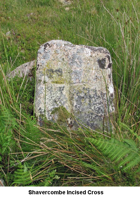
This cross, which has been incised onto a low rock on the north-east bank of the Shavercombe Brook, was brought to Maurice and Glenn's attention by a couple of keen letterboxers in April 2014. We've not been able to find any written information on the cross and can only suppose that it was incised on this rock in remembrance of someone who perhaps died at this spot or favoured this area of the moor. (Source: Maurice). 4) Blackaton Cross (SX5705/6310) It was noted on the walk that the shaft of the Blackaton Cross was chamfered on one edge only which, on the face of it, seems rather unusual. There is a logical explanation for this as provided by the Dartmoor Crosses webpage: 'Sadly, only the head and socket of this cross are original, the shaft being a relatively modern replacement. This was taken from a windowsill at the nearby Lee Moor House and donated by the occupant, Mr Phillips. Signs of its former use can still be seen in the chamfered edge on one corner only of the shaft. On the eastern face of the shaft there are three indentations; the top two are 3 inches in diameter, with the third being 2 inches in diameter and 1 inch deep. These were probably originally drilled in order to fix the windowsill into place. Previously, the head sat directly into the socket stone and it was Mr Phillips, himself, who fitted the shaft and restored the cross to its former glory'. (Source: www.dartmoor-crosses.org.uk).
|
| May 2014 - South Zeal |
|
1) Kennon
Hill Boundary Stone / Incised Cross (SX6735/8950) All the Dartmoor reference books that mention the Kennon Hill Boundary Stone / Incised Cross, refer to it as just that - A Boundary Stone with a 'G' for Gidleigh Parish on its south east face and an Incised Cross on its north east face. However, my theory is that it was erected purely as a Boundary Stone to mark the boundary of the parishes of Gidleigh (G) and Throwleigh (T). At some point, someone has come along and extended the vertical stroke of the 'T' to above the arms and turning it into what looks like an Incised Cross. My reasons for this theory are that the stone stands on the boundary of the two parishes (Gidleigh/Throwleigh), it looks as though the incised 'T' is about the same size as the 'G' and at the end of each arm there is a faint trace of them being 'turned down' in the same way as happens with the capital ' T ' in many font styles (the preceding example is Times New Roman). (Source: Maurice's Theory & Eric Hemery's High Dartmoor, page 796). 2) Bert Gratton's House - Blackaton Brook (SX6435/9006)
|
| March 2014 - Hexworthy |
|
1) Dolly Trebble's House (SX6435/7258)
The books record that Dolly was a very attractive girl and, besides Dolly's Cot, spent some time living at Hexworthy and Prince Hall Lodge. It was rumoured that the Prince Regent took a fancy to her during a party when he was staying with Sir Thomas Tyrwhitt at Tor Royal, but there is nothing to substantiate whether anything happened between them. It is likely that the reason for the move to Dolly Trebble's house was not so much as to get her away from the Tor Royal area, but that it was more convenient for her husband, due to his agricultural labouring work in the West Dart and Swincombe areas. In later years, both Dolly and William worked as miners at the Hooten Wheals Mine. Dolly outlived her husband by a couple of years and was aged 88 when she died at the home of one of her sons at Foggintor in 1879. (Source: Bob W’s Census Returns, Eric Hemery's High Dartmoor, pages 364 & 560 and John Hayward's Dartmoor 365, page 268). 2) Peat Cot (SX 605/715) The settlement of Peat Cot, which consisted of a farm and labourers' cottages, was originally built by Sir Thomas Tyrwhitt, of Tor Royal, and was later purchased by the Duchy. The farm was occupied and run by the Worth family for several generations, with Charlotte Worth, daughter of 'Baker Edwards' at Princetown, being labelled as the 'Mother of Peat Cot'. The community were stout Weslyans and for many years met in the large downstairs room of one of the cottages every Sunday afternoon. It was later decided to build the Wesley Chapel and this was completed in 1912. Richard Hansford Worth (Engineer, Archaeologist & Author) and his wife. Annie, would sometimes attend the service, with Annie playing the chapel harmonium to provide the music. The chapel has now been closed down, with the building being used as a storeroom. (Source: Eric Hemery's High Dartmoor, page 343).
|
| February 2014 - Shipley Bridge |
|
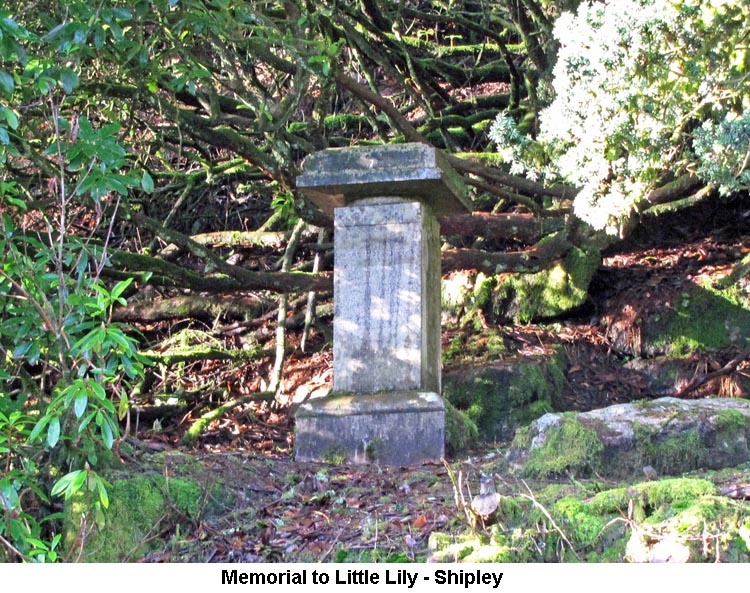
1) Memorial
to Little Lily (SX6832/6344)
Francis
and Caroline had four children: Mary (nicknamed ‘Little Lily’), born
on 9th October 1858; Ida, born on 30th July 1860; Godfrey born on 2nd
September 1862; and Edward born on 28th March 1864. It
seems as though two of the children suffered greatly from ill health, as
first Mary became seriously ill as a young child and was taken to
Caroline’s parent’s house, at the Whitestone Rectory, where she could
receive the care of her grandparents. Mary eventually succumbed to
her illness, dying of Tonsillitis and Laryngitis on 27th March 1863, aged
only 4 years old. Later that same year, Mary’s brother, Godfrey
died on Christmas Day (25th December), at the age of only 1 year, from
Bronchitis and Convulsions.
Francis died on 26th February 1870, at Dawlish, with the reason for death being shown as 'Ileus (3 months) and exhaustion'. He is also listed as being buried in the Whitestone Churchyard. Caroline outlived her husband by some 27 years and, some time after his death, moved to London living in Hammersmith. She died on 21st March 1897 from Nephritis and, again, was brought back to Devon to be buried in the churchyard at Whitestone. Mary
was obviously a favourite of her father and, following her death, he
erected a memorial to his ‘Little Lily’ in the garden of Brent Moor
House. Although the house has been demolished, the memorial stills
stands erect on a substantial rock, where there was once a lily pond
below, well back from the track and often hidden by the overgrowing
Rhododendron bushes. The memorial is in the form of a pillar which
has been inscribed as follows: 'M.M. / MARCH 27TH 1863 / MY LOVELY
LITTLE LILY / THOU WERT GATHERED VERY SOON / IN THE FRESH AND DEW MORNING
/ NOT IN THE GLARE OF NOON. / THE SAVIOUR SENT HIS ANGELS / TO BEAR THEE
HENCE MY OWN. / AND THEY'LL PLANT THEE IN THAT / GARDEN / WHERE DECAY IS
NEVER KNOWN'. Brent Moor House was later abandoned and
subsequently demolished in 1968. Eric
Hemery (High Dartmoor, page 328) and other Dartmoor writers refer,
incorrectly, to Mary as ‘Margaret’ and they also attribute her early
death to the result of a fall from her horse when out riding. We
don’t have any real evidence that Mary had ever fallen from a horse and,
as her death is listed as being due to Tonsillitis and Laryngitis, that is
not consistent with The
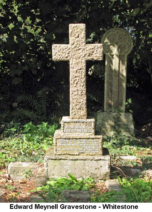
link between Caroline and Whitestone was made by Maurice on seeing a
plaque in the Whitestone Church, where she has been recognised for
restoring the South windows in memory of her husband and her two children
who died very young. My thanks to Bob for
spending many hours undertaking the ancestry research on the Meynell
family and coming up with a lot of interesting data. (Source:
Bob's Ancestry research and Maurice's artefacts and information gathered
from his visit to Whitestone Church - Notes rewritten May 2022). 2) Keble Martin's Chapel (SX6663/6660)
3) IHS Inscription & Incised Cross - Middle Pupers (SX6728/6737) On the South West face of the main rock at Middle Pupers, and partly hidden by an overhung rock above it, is the inscription 'IHS' with an incised cross above the letter 'H'. In the ancient world of medieval Western Europe this was a Christogram, with the letters, Iota (I), Eta (H) and Sigma (S) representing the first three letters of 'Jesus' in the Greek alphabet. Another interpretation was that the three letters stand for 'Iesus Hominum Salvator' (Jesus, Saviour of Men) in Latin, but this has since proved to be inaccurate. The Latin symbol now has a 'V' below the IHS to represent 'In Hoc Signo Vinces' interpreted as: 'In This Sign You Will Conquer'. The symbol, in one form or other, has been used throughout the Latin speaking world since the seventh century and the first use of it in an English document dates from the fourteenth century. The cross above the 'H' forms an integral part of the symbol. For more information on how 'Pupers' is supposed to have derived its name, please see Research Item 3 from the walk in June 2013. (Source: Wikipedia Internet ). 4) Boundary Stones - Dockwell Ridge This line of boundary stones, which run in a straight line from Dockwell Hole (SX697/642), over Dockwell Ridge to Small Brook Foot (SX682/645), mark the boundary between the commons of Dean Moor and Brent Moor. The stones are plain, having not been inscribed, and one (SX6941/6434) is known by the name of 'Grey Goose'. (Source: William Crossing's Guide to Dartmoor, pages 368 & 386).
|
| January 2014 - Parke, Bovey Tracey |
| 1) Marker Stones at
Parke House (SX8059/7855) Outside the front door of Parke House there are three marker stones. Two of these stones, one each side of the entrance porch, are engraved SDR (South Devon Railway) and it is quite likely they came from the Moretonhampstead to Bovey Tracey line, as this ran through the grounds of Parke. (Source: Dave Brewer's: Dartmoor Boundary Markers, page 230). The Moretonhampstead & South Devon Railway (as it was originally known) came into being by Act of Parliament on 7th July 1862 when a branch line to connect Moretonhampstead to Newton Abbot had been proposed. The line opened on 26th June 1866 and was worked by the South Devon Railway to whom ownership passed to in 1872. Six years later it was absorbed by the GWR. It was originally broad gauge (seven foot and half an inch between the rails) but converted to narrow gauge (four foot eight and a half inches between the rails) from 1892. They say its hey day lasted until the advent of mass motoring in the 1930's after which decline set in, and during BR tenure it was allowed to run down prior to closure in 1959. (Source: RW). The other stone is engraved DNP 40, which, it is assumed, commemorates the 40 years since the Authority became an elected body. (Source: MD). 2) Packsaddle Bridge (SX7892/8023) This low bridge we crossed, just after turning left at Drakeford and beside Ivy Cottage, spans the Wray Brook and is referred to by William Crossing as Packsaddle Bridge. (Source: William Crossing's: Guide to Dartmoor, page 304). 3) Drakeford Bridge (SX7895/8013) The eastern stone parapet of the bridge contains an engraved tablet which records repairs made to the bridge many years ago. The wording reads: This 1684 Bridg was Repard by the County (Spelling as on the tablet) (Source: MD). This bridge, over the River Bovey, appears to have two alternative names: William Crossing calls it 'New Bridge' (Source: Crossing's: Guide to Dartmoor, page 304) and there is a reference to it on the internet as 'Letford Bridge'. (Source: Legendary Dartmoor Internet Site). The David Thomas article provides further information: "Bridge over River Bovey. 1684 or earlier, widened 1809 by James Green, county surveyor. Granite. Consists of a single elliptical arch. The downstream side of this arch, which seems to belong to the 1684 build, has fairly roughly-shaped voussoirs. Above it, corbelled out slightly, the parapet is of granite rubble having a coping with rounded top. On its inner face, which is of granite ashlar, is a worn granite tablet which seems to read : 'This 1684 bridge was repaired the....'. The upstream arch seems to belong to the 1809 widening; its voussoirs being better cut; its parapet is similar to that on the downstream side, faced with granite ashlar only towards the road". (Source: British Listed Buildings Internet Site).
We, as a group, have walked past this stone several times on our previous walks without realising it had been given a name. We've not been able to trace the source of the name, except to say it is shown on the notice board at the entrance to Houndtor Wood (Ref: SX789/800). (Source: CW/MD).
|